Monday, November 8, 2021

Tree species classification using very high reslolution satellite imagery for Da'an Park


There are more than 60,000 tree species Worldwide, and they could be grouped into two primary categories: Deciduous tree and Coniferous trees.

Deciduous tree are also called hardwoods, these tree types typically shed their leaves in autumn. Deciduous trees have different-shaped leaves, depending on tree species; for example, star, heart and oval shapes It refers to the trees that shed leaves seasonally, and most of the broadleaf trees are deciduous. It has a high rate of photosynthesis because of the shape and the arrangement of the leaf patterns. Shedding leaves prepare them for winter and have good water preservation. Since there is seasonal shedding, these trees are affected by winter weather conditions.

Most of Coniferous trees are evergreens, which means you'll have greenery year-round on these tree types. Coniferous trees have leaves that are needle-shaped.

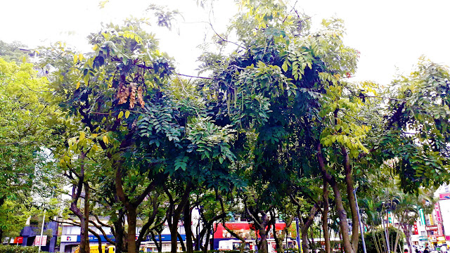
In Da'an Park, there are about 14 typical trees species, which mainly belong to the Decidous group, including: Alstonia scholaris, Bischofia javanica, Ficus elastica, Ficus microcarpa, Bambusa vulgaris, Tabebuia aurea, Liquidambar formosana, Pistacia chinensis, Pterocarpus indicus, Cinnamomum camphora, Morus australis. Conifer species include Araucaria heterophylla and Roystonea regia (Palm), the rest are grasses.

In this study, we classified the flora in Da'an Park into 7 main categories, including 4 types of Deciduous group: Tree type 1, tree type 2, tree type 3, and tree type 4. Besides, There are also classes Palm, Conifers, and Grass (Table 1)

Table 1. Tree species classification in Da'an Park
 
Google Earth images - very high-resolution satellite images are used for classification. It was derived on 23th, March, 2018 with 3 visible bands: Red, Green, and Blue (Figure 1)
Figure 1. Google earth image of Da'an Park

A total of 316 photos of trees in Daan Park were taken for training and validating of the classification model using Decision Tree algorithm (Figure 2). The results of the classification model give an accuracy of up to 89.98%
Figure 2. General workflow of tree classification


The results of tree species classification in Da'an Park showed that Deciduous trees occupy most of the park's area, of which type 2 trees occupy the most, up to more than 11 hectares, followed by type 1, type 3, and type 4. Conifers occupy only a small area, only about 0.2 ha. Meanwhile, the area for grass and flowers occupies an area of up to 7.2ha.
Figure 3. The final tree classification of Da'an Park

Tree species sampling in Da'an Forest Park


Daan Forest Park - a green lung of Taipei - is a public park near the centre of Taipei city, Taiwan. The park occupies twenty-six hectares, and is used by residents of Taipei as a green activity space and for various outdoor activities.

The purpose of the tree sampling field trip in Da'an Park was to classify tree species using Satellite images. Samples used for training, testing, and validating from supervisor classification model by artificial intelligence algorithm.

How can we differentiate between types of trees? There are few key things to look at in order to tell trees apart. Some of these are dependent on the season. For example, we can rely on differences in leaves, flowers, fruit, or cones.

In this field trip, the characteristics of each species was identified from ‘‘tree’’ pictures taken with a RICOH WG-4 GPS Camera and total 316 points with corresponding Geotagged photos were used as dataset for training and validation the results.

The points of tree sampling

Below are some pictures of trees in the Da'an Park
Alstonia scholaris (deciduous tree)


Bischofia javanica (Deciduous Trees)

Ficus elastica (Deciduous Trees)

Ficus microcarpa (Deciduous Trees)


Bambusa vulgaris (Deciduous Trees)

Tabebuia aurea (Deciduous Trees)

Liquidambar formosana (Deciduous Trees)

Pistacia chinensis (Deciduous Trees)

Pterocarpus indicus (Deciduous Trees)

Cinnamomum camphora (Deciduous Trees)


Morus australis (Deciduous Trees)

Araucaria heterophylla (Coniferous Trees)


Roystonea regia (Palm)

Flowers and Bushes

Grass


Water

For more pictures, please see here 

Publication list

1. Liou, Y.-A.*, Nguyen, K.-A, Ho, L.-T., 2021. Altering urban greenspace patterns and heat stress risk in Hanoi city during Master Plan 2030 implementation. Land Use Policy 105 (2021) 105405. https://doi.org/10.1016/j.landusepol.2021.105405. (SSCI, IF = 5.398, RF = 28/123, Environment Studies)

2. Nguyen, K.A., Liou, Y.-A.*, T.-H. Vo, D.C. Dao, H.S. Nguyen, 2021: Evaluation of urban greenspace vulnerability to typhoon in Taiwan. Urban Forestry & Urban Greening, Volume 63, August 2021, 127191, https://doi.org/10.1016/j.ufug.2021.127191. (SCI, IF=4.537; RF = 3/68, Forestry)

Thursday, June 24, 2021

Evaluation of urban greenspace vulnerability to typhoon in Taiwan


                                  Evaluation of urban greenspace vulnerability to typhoon in Taiwan

Authors: Kim-Anh Nguyen, Yuei-An Liou, Trong-Hoang Vo, Dao Dinh Cham, Hoang Son Nguyen

https://doi.org/10.1016/j.ufug.2021.127191

Journal: Urban Forestry & Urban Greening. (SCI, IF=4.021; RF = 3/68, Forestry)

Abstract

Urban greenspace (UGS) represents an essential component of city ecosystems. It plays a critical role for various purposes, such as reducing urban heat island effect and air pollution, regulating torrential run-off and offering joyful routes for walking, jogging and cycling based on personal interest as well as a platform for social networking. It is especially important in a populated country like Taiwan with population highly concentrated in cities. It is rather vulnerable to strong winds and heavy precipitation brought up by typhoons, while there are no existing frameworks to access its vulnerability to typhoons in Taiwan.

Here, we examine the vulnerability of UGS to typhoons in Taiwan by a novel assessment framework considering 21 indicators organized into three dimensions, including hazard, exposure/sensitivity and adaptive capacity. The 21 indicators are derived from the Sentinel-2 MSI data obtained from European Space Agency (ESA), typhoon data acquired from Japan Meteorology Agency (JMA), and census data achieved by the government official sites of Taiwan. Google Earth Engine and GIS are used to analyze the deviation of UGS variables. Five major metropolitan areas of Taiwan are selected as the study sites, consisting of Taipei, New Taipei, Taoyuan, Taichung, and Kaohsiung cities. Interestingly, it is found that (i) There exists a great spatial gap between hazard levels and the top-priority regions to enhance the strategies and adaptive capacity in order to better respond to typhoons in Taiwan; (ii) The Northern and middle parts of Taiwan exhibit high and very high hazard levels since the occurrence frequency and wind speed of typhoons are higher. In contrast, the Southern Taiwan is characterized by low and very low hazard levels occupying over approximately half of the study sites; (iii) Exposure and sensitivity of the UGS in Taiwan vary greatly from very low to very high levels over the study sites with 43 % attributed to high and very high levels; and (iv) 22 % of the metropolitan areas are classified as high and very high vulnerable, mainly distributed over the Taoyuan, Taichung, Taipei, and New Taipei cities. Results suggest that the presented framework is useful in evaluating the vulnerability of UGS to typhoons and implicates proper management of urban trees as a nature-based solution to mitigate the impacts of climate change.


Altering urban greenspace patterns and heat stress risk in Hanoi city during Master Plan 2030 implementation


Altering urban greenspace patterns and heat stress risk in Hanoi city during Master Plan 2030 implementation

Authors: Yuei-An Liou, Kim-Anh Nguyen, Le-Thu Ho

https://doi.org/10.1016/j.landusepol.2021.105405

Journal: Land Use Policy 105 (2021) 105405. (SSCI, IF = 3.682, RF = 28/123, Environment Studies)

Abstract

Hanoi City has been greatly reshaped owing to its “Master Plan by 2030 and a vision to 2050 by Decision 1259/QD-TTg of Vietnam” (called Hanoi Master Plan thereafter). This Hanoi Master Plan results in multi-challenges for the Hanoi City in terms of conserving urban greenspace (UGS). This study pursues to (1) investigate the changing environmental spatial patterns of UGS, (2) identity the areas at high risk due to heat stress based on abnormal land surface temperature (LST) distribution and demographic vulnerability, and (3) suggest mitigation strategies to the authorities by using the proposed UGS management platform. Sentinel-2 multispectral instrument (MSI) data was used to examine the evolution of UGS in relation to LST derived from Landsat 8 OLI thermal band that was subsequently utilized to create heat stress risk patterns. The study region is the inner Hanoi City. The UGS was investigated during the timeframe from Oct. 2016 to Oct. 2018. Accuracy assessment was performed by using Google Earth and field survey data. Results showed that UGS in inner Hanoi City is much declined by 1.3% for woodland and by 4.4% for shrub land, while grass-cover is increased by 2.4% in recent 2 years. Overall accuracies are of 96% and 88% with Kappa coefficients of 0.92 and 0.78 for land cover classification in 2018 and 2016, respectively. Urban heat stress index patterns showed a higher risk in the central inner-city areas of dense residential regions characterized by dense built-up. The identification of environmental heat stress risk patterns provides useful information for calling more attention of urban planners, authorities and health organizations.


Monday, July 15, 2019

About project


Innovative technological platform to improve management of green areas for better climate adaptation in urban area. GIS and remote sensing assessment framework for urban greenspaces vulnerability to typhoons in Taiwan


Contact:
Prof. Yuei-An Liou
Hydrology Remote Sensing Laboratory
Center for Space and Remote Sensing Research
National Central University
 

News

Blogroll

About

Innovative technological platform to improve management of green areas for better climate adaptation in urban areas